![]() Home Page
Home Page
Fort Stanton Cave Study Project: July-4-2022
|
Fort Stanton Cave Study Project: July-4-2022 |
Fort Stanton Cave - Selected Photos Page 2
Photo Pages |
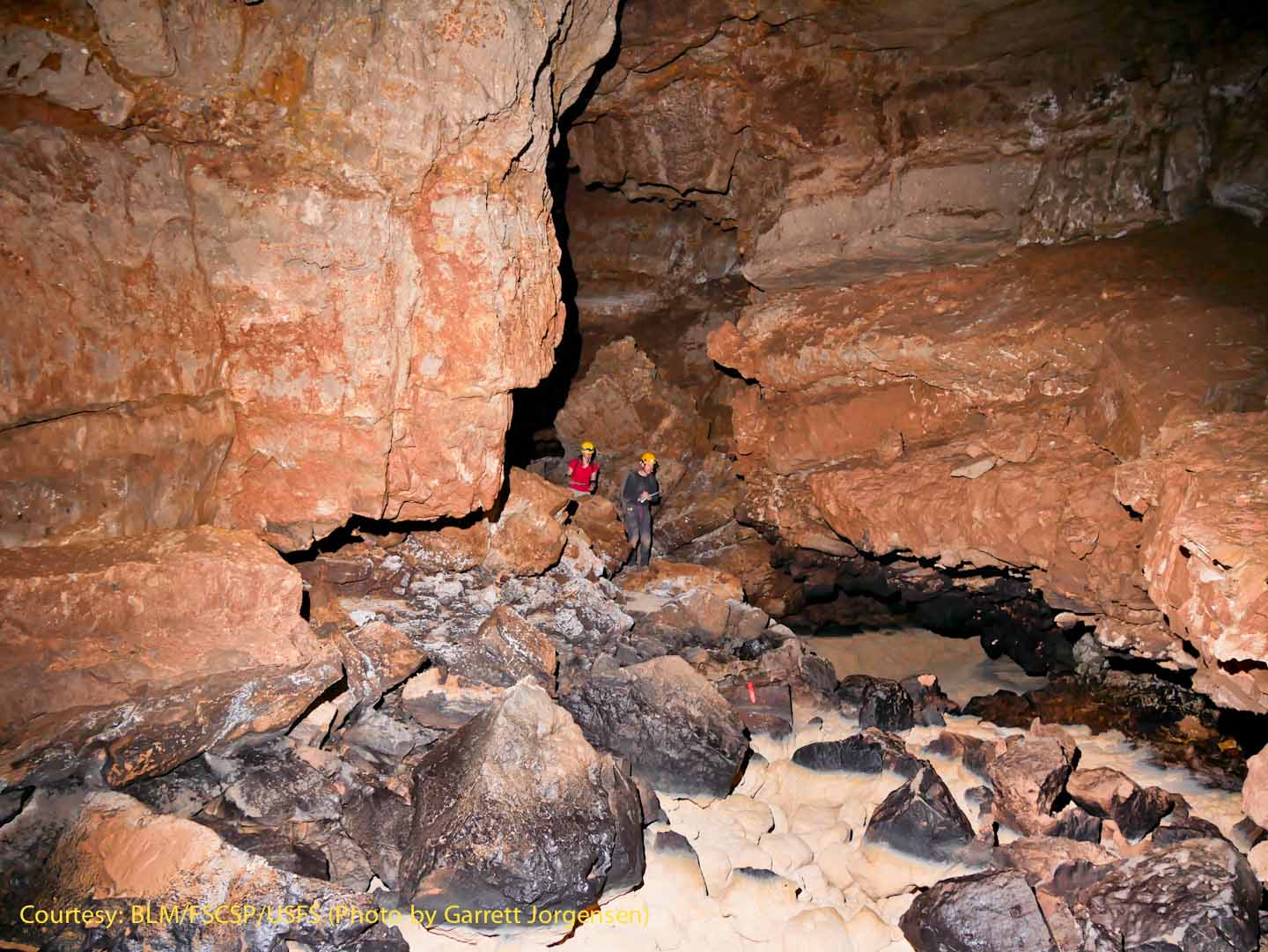
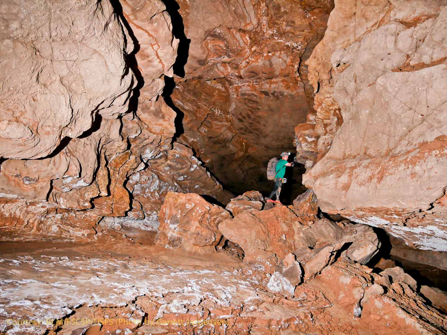
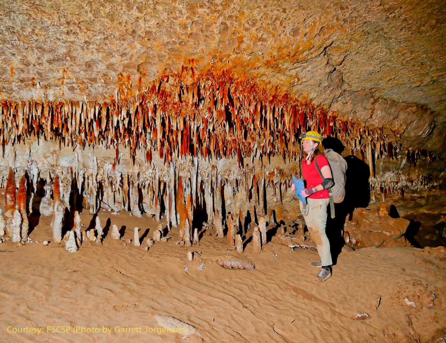
The planning for this trip started in August, 2014, when a science team studying the visible sediments on the banks of Snowy River made it about halfway up the Snowy River Passage, and turned back when they met flowing water. At that time they quickly headed back down the passage towards a low area called Mud Lizard. Although the Snowy River flow was only about half as fast as the team was walking downstream on a dry calcite floor, they wanted to make sure they passed the low area before the water arrived. In October of 2014 the flow reached the Turtle Junction access point and continued for the next four years! Several years later the "Black Rock Bypass" was discovered and today the teams use that passage when heading to the Midnight Junction Camp area and beyond. Prior to a trip a team leader will write a proposal which is submitted to the BLM in January of every year. Access is currently limited in numbers due to the White Nose Syndrome (WNS) regulations that require special decontamination of cavers and gear going in, and coming back out of the cave. Currently just over 120 entry permits are issued each year with many science, survey, photography and exploration proposals being placed on a waiting list for the following years. For those proposals that are accepted and given the "go-ahead", the team leaders begin detail planning and working with qualified team members suitable for the survey and research being proposed. There is a strong local New Mexico volunteer group that usually attends the three main expeditions each year and our "strong and light" team members from New Mexico are able to quickly respond to the more challenging 24+ hour-long trips. The "S&L" qualified cavers are obviously "strong", but their 35-45 pound packs are not exactly "light". They are only "packed light" similar to back-packers (25-30 pound packs) where every ounce counts. In addition, Snowy River cavers have to pack in shoes and clothing for both "clean" and "dirty", food and water for the trip, and everything that goes in has to be carried out (including gear, scientific samples and human waste). Special "Snowy River packs" are designed with an outer cover and during some trips multiple changes are made from clean to dirty and back again. For the most challenging trips we often have team members that join our teams from other states and many have worked together at other project caves across the country. Once it was determined that Snowy River had not flowed for several months, the detail planning for work beyond the Midnight Junction Camp immediately started. For this July 2022 trip to far south Snowy River, Adam Weaver and Rene Ohms were from South Dakota, Derek Wolfe was from Colorado, and Garrett Jorgensen is from New Mexico. |
At SRS745 the top surface of the Snowy River water flow is quite obvious. This waterline appears to be about 750 years old and is called the Snowy River Formation Top (SRFT)
|
|
A potential data logger site near SRS745, the SRFT indicates multiple levels of flow. The multiple darker bathtub rings above the SRFT are similar to those downstream from Turtle Junction, perhaps even larger. The calcite deposit is relatively continuous and is recognized as the longest cave formation in the world. In the center of the passage, it is likely over an inch thick. When dry, cavers can walk on it with clean shoes or shoe covers or without causing significant impact. |
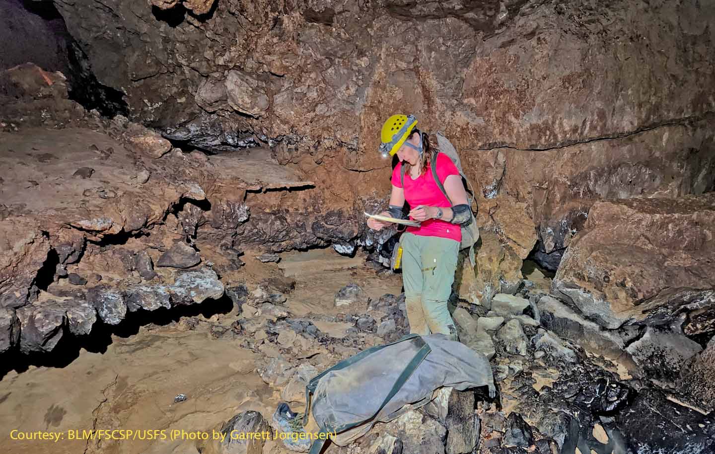
Rene sketching profiles in SRS745 "Sue Falls" area.
|
At SRS746 the passage cross section increases and the lack of clay high on the walls indicates past flooding prior to the Snowy River flows. |
|
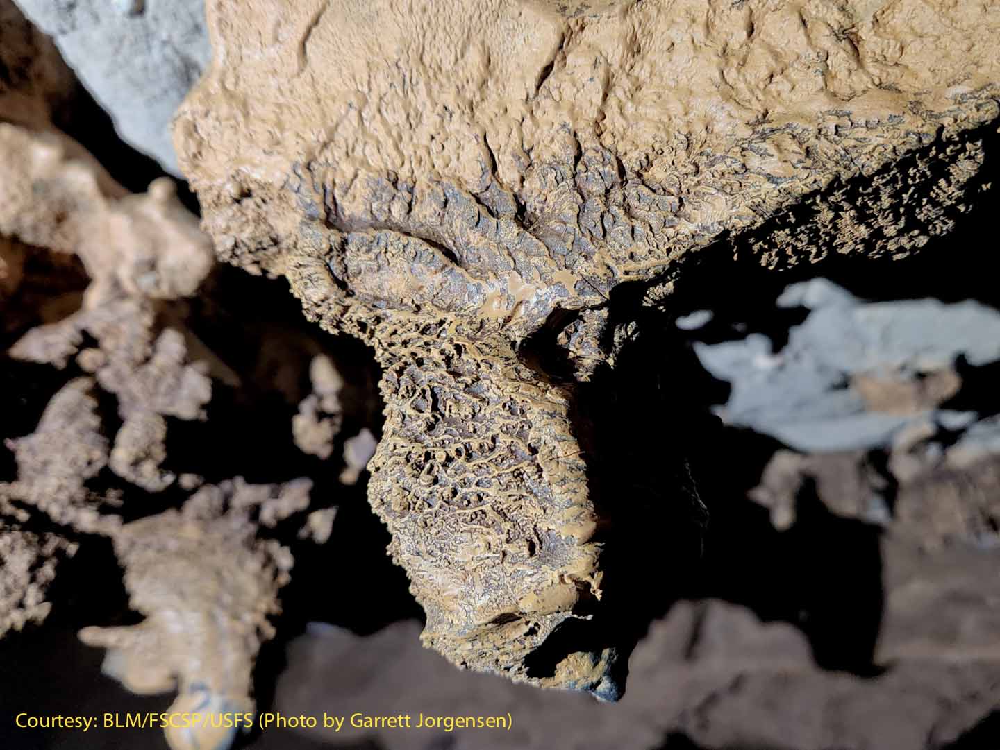
At SRS747 this ceiling pendant with a strange coating was noted. Could this be some sort of box-work? |
|
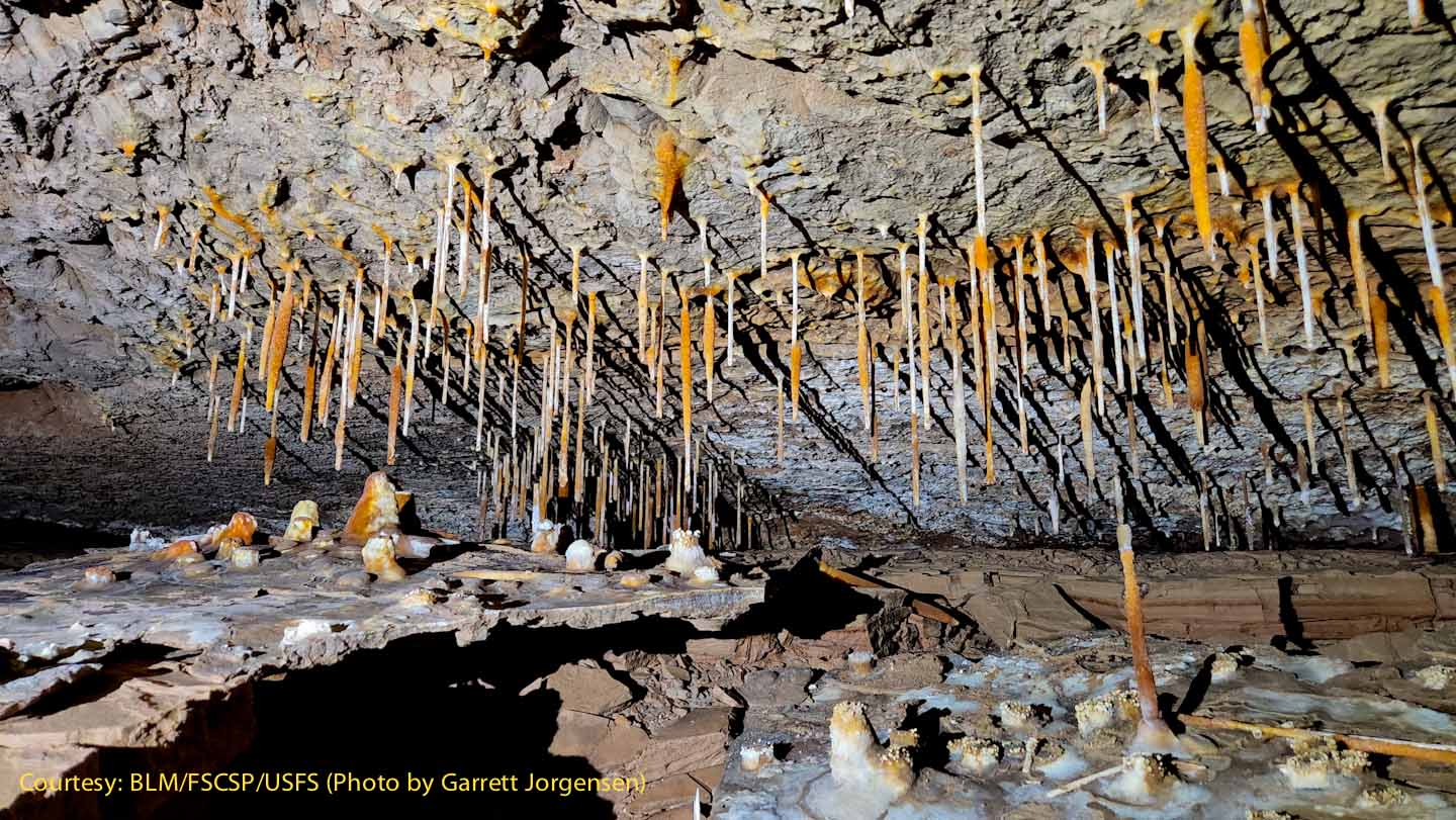
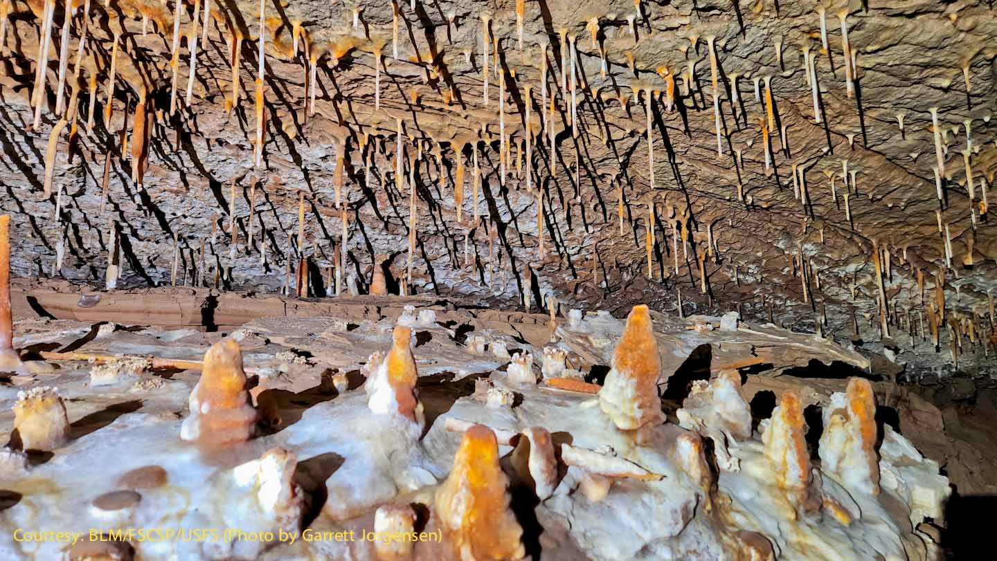
For scale, these "soda straws" are about the diameter of a water drop or ~ 1/4”. The ledge on the left was once the floor of the passage. Flowstone was deposited on top of mud. Then sometime later, the mud was washed away, leaving this hanging ledge. |
Another view of the soda straws and stalagmites on the ledge. Note how the stalagmites are differentially coated with a white deposit, an indication that air blowing through the passage may cause the coating to be deposited only on one side. It looks like snow drifts!
|
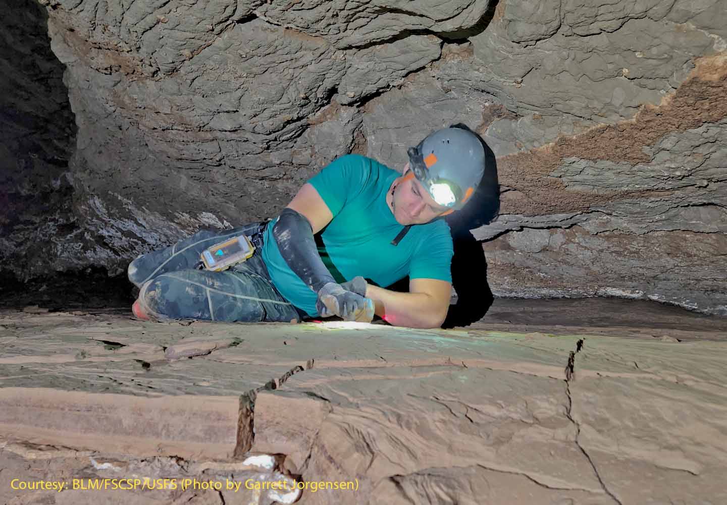
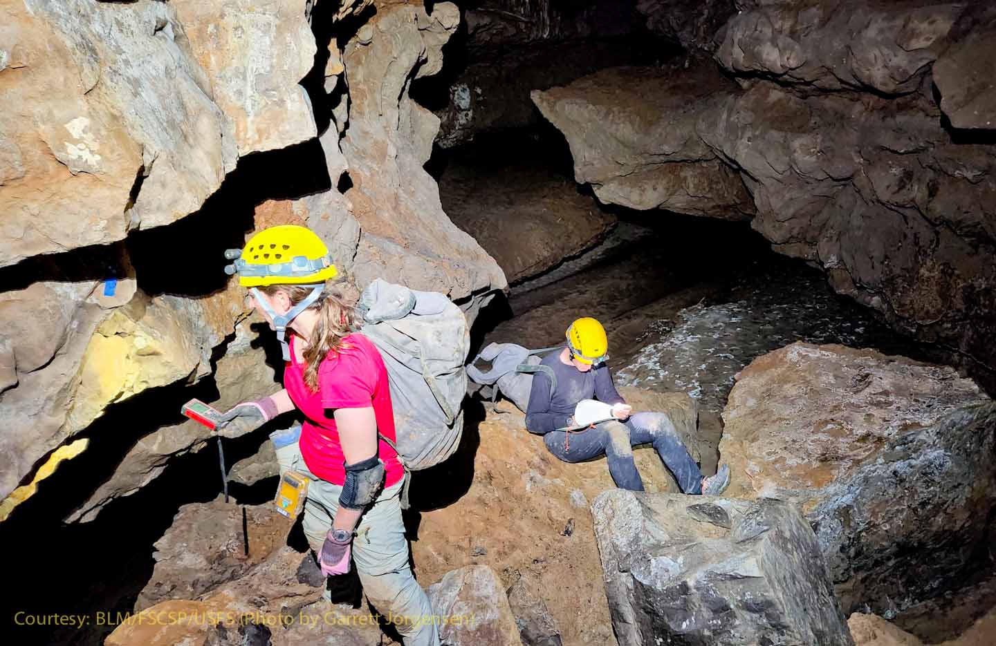
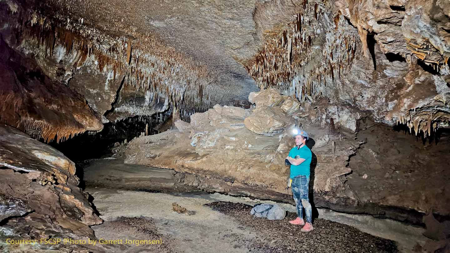
Adam setting station SRS748 on top of a cracked clay bank. If you look closely, you'll see a laser dot on his left arm, generated by a laser range-finder located at the prior station. Hanging from Adam's belt is the DIstoX2 instrument in a waterproof container. He will use that to make a back-sight towards that prior station.
|
|
Looking out from the top of the clay bank towards the next SRS750 station is a large section of passage. |
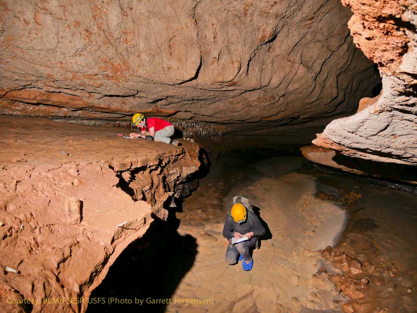
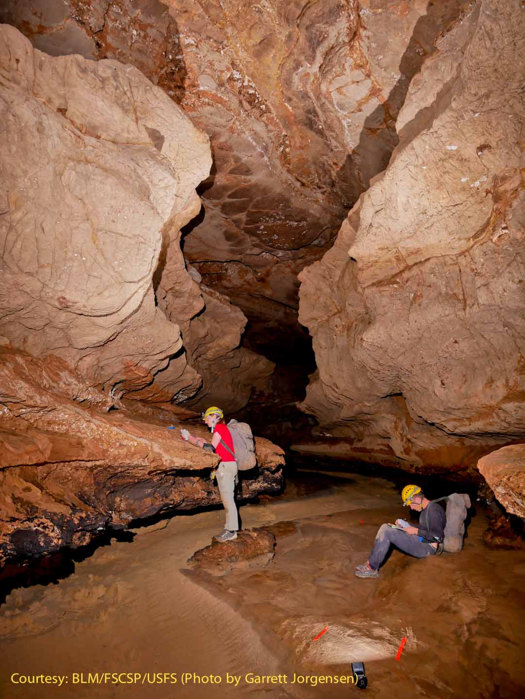
Rene and Derek sketching. Rene is drawing a profile of the passage, and Derek is drawing the plan view and cross sections. They are following a survey-as-you-go policy - the passage must be documented as you explore. |
|
Rene and Derek sketching as the team climbs higher above the floor. |
Near SRS752 the Snowy River Passage continues into the darkness. |
|
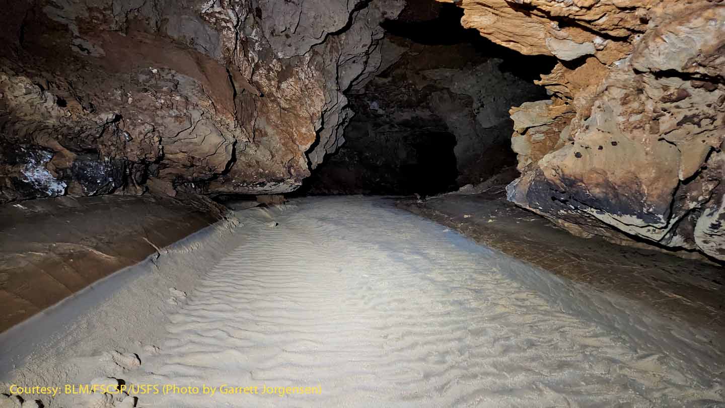
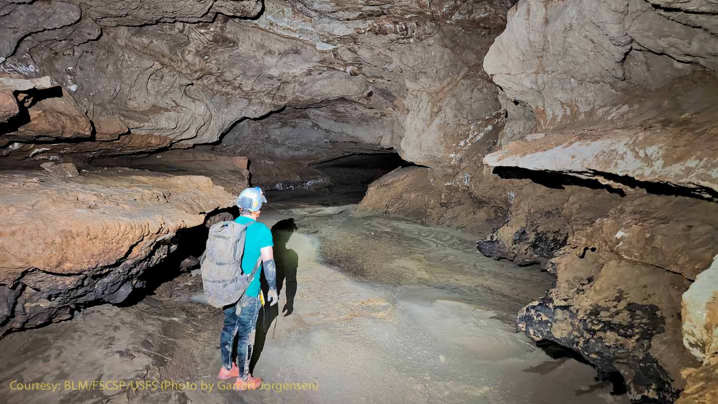
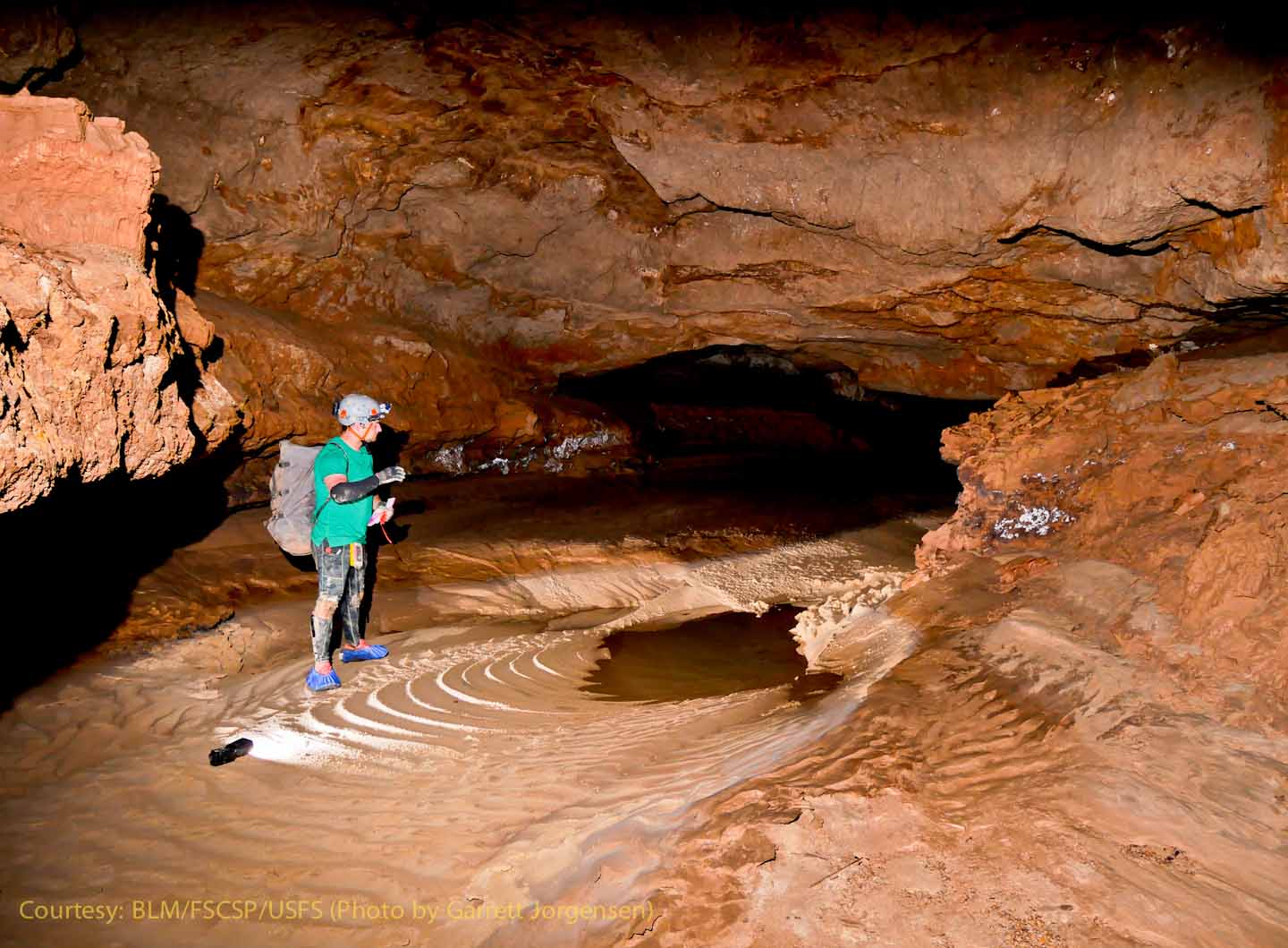
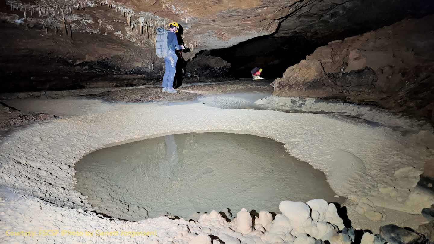
At this point the team is in the "clean mode", using shoe covers to protect the white calcite. Several pools were in the floor as the team continued upstream. The "ripples in the calcite covered sand illustrate historical flows before the calcite layer formed. |
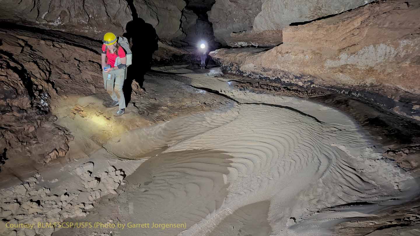
Near SRS752, the team switched to "dirty mode" and are walking on the clay bank instead of the white calcite. The orange flagging next to the strobe light marks the way for future visitors.
|
|
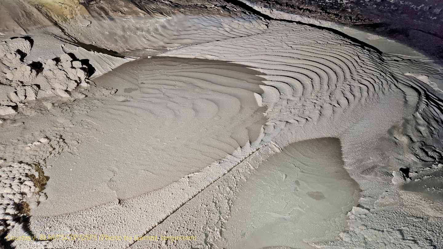
Looking downstream from the pool, it is easy to imagine Snowy River flowing just a few inches deep over the calcite-covered sand ripples.
|
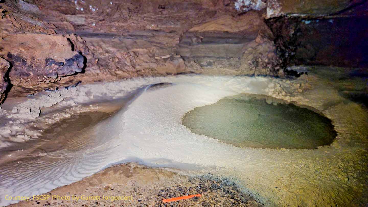
The pool at SRS752 has a very unique feature - almost like a ledge on a small ridge that drops off into the lower pool. (An enlargement may indicate this straight line is related to a lower layer of rock with a broken, straight edge.) |
|
Just upstream is another small pool, apparently sitting on top of sediments, that has a similar drainage into a lower pool when Snowy River is flowing.
|
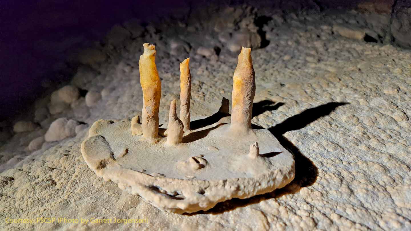
Nestled on a fragment of rock sitting on the floor of Snowy River, it is not clear if these were formed as stalactites (ceiling) or stalagmites (floor). Was an earthquake responsible for the change of position?
|
|
A clue just a few feet away may be the explanation for the item on the floor. Are these older calcite formations that formed before the flood waters washed away the clay and a slower flow deposited the calcite? |
As the survey advances, the team has to decide the best conservation path, mark it and change out shoes or shoe covers to protect the calcite.
|
|
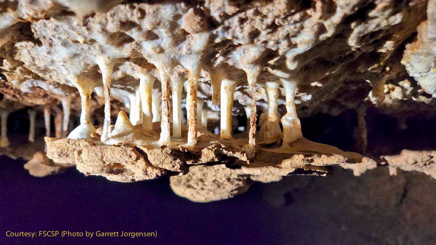
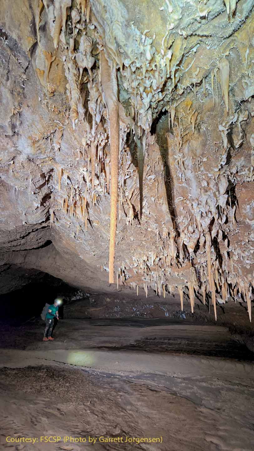
Usually the stalactites are much higher above the Snowy River Passage.
|
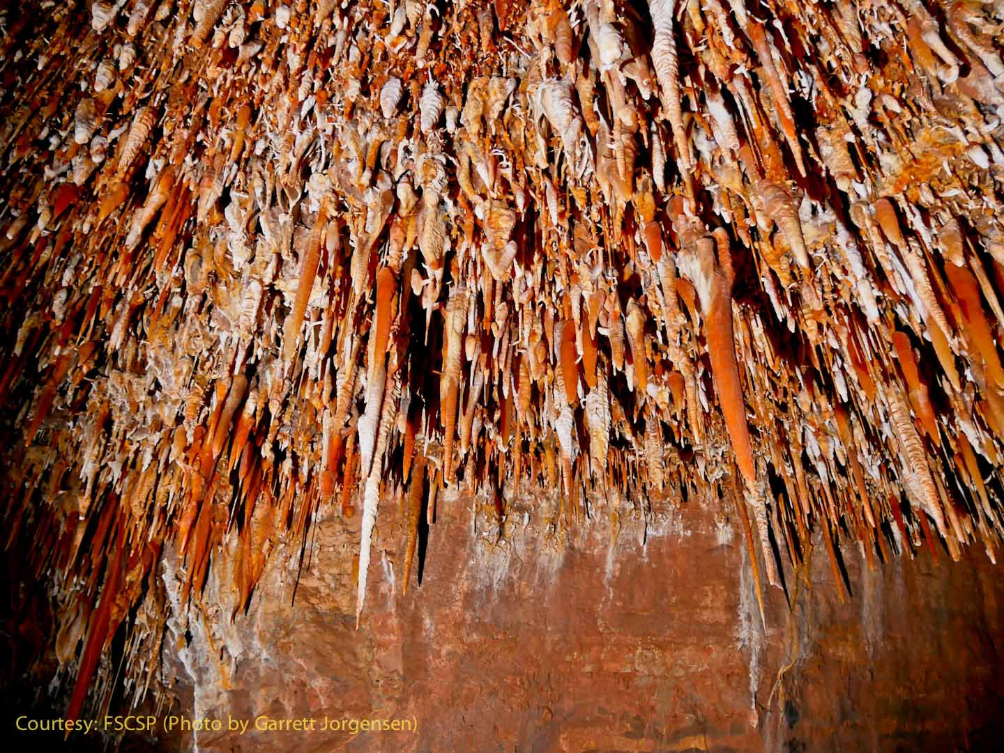
Near SRS754 an impressive ceiling collection is seen high above. Note the natural breakage of a few of the red stalactites on the floor below. |
|
Another view of the ceiling decorations.
|
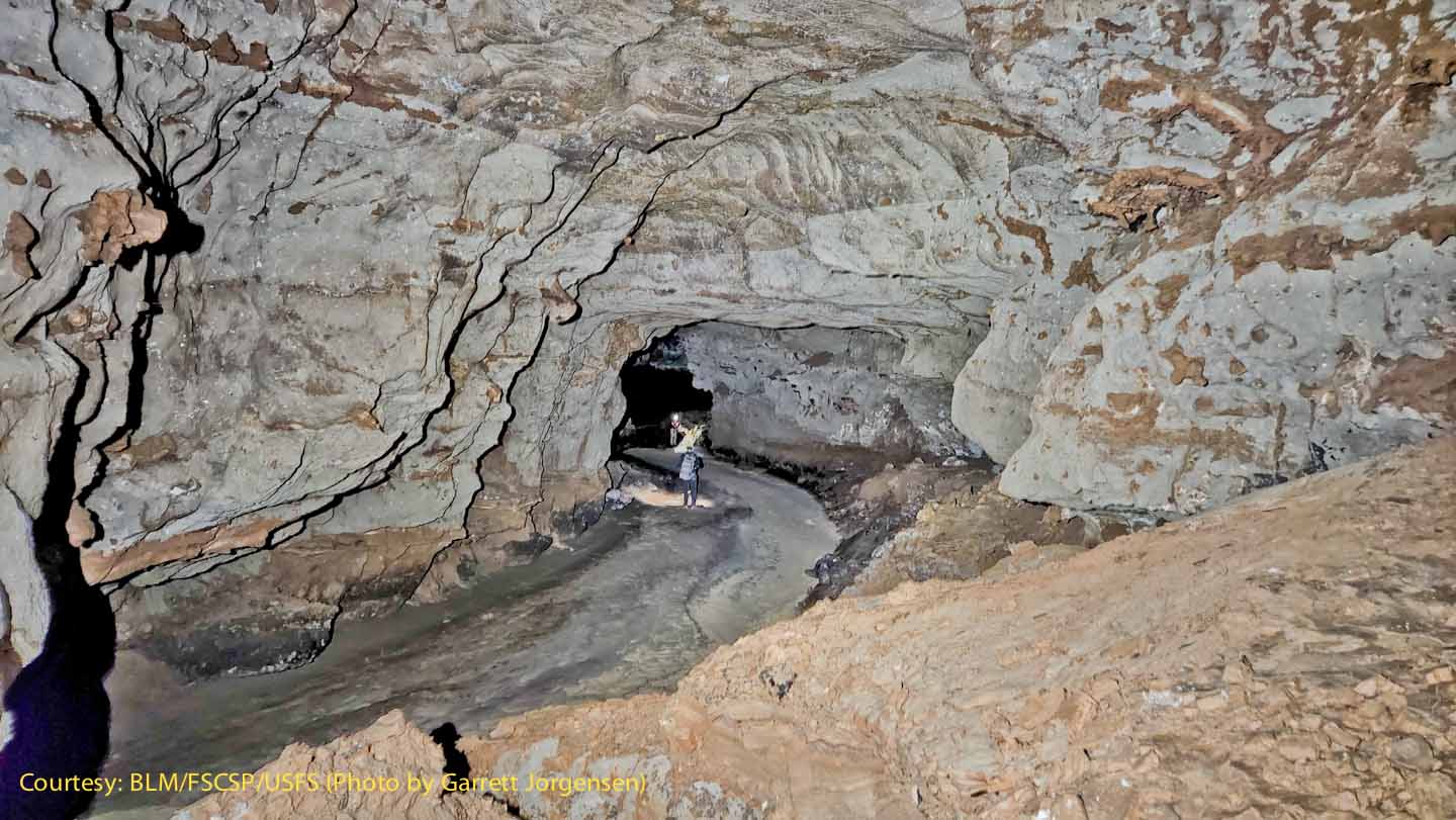
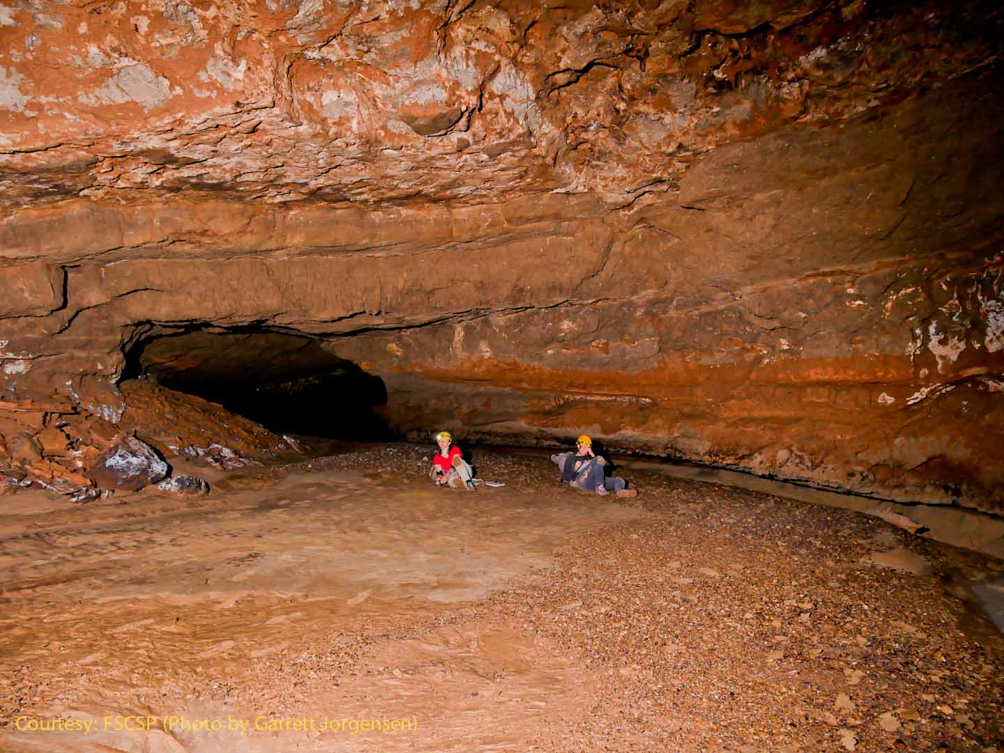
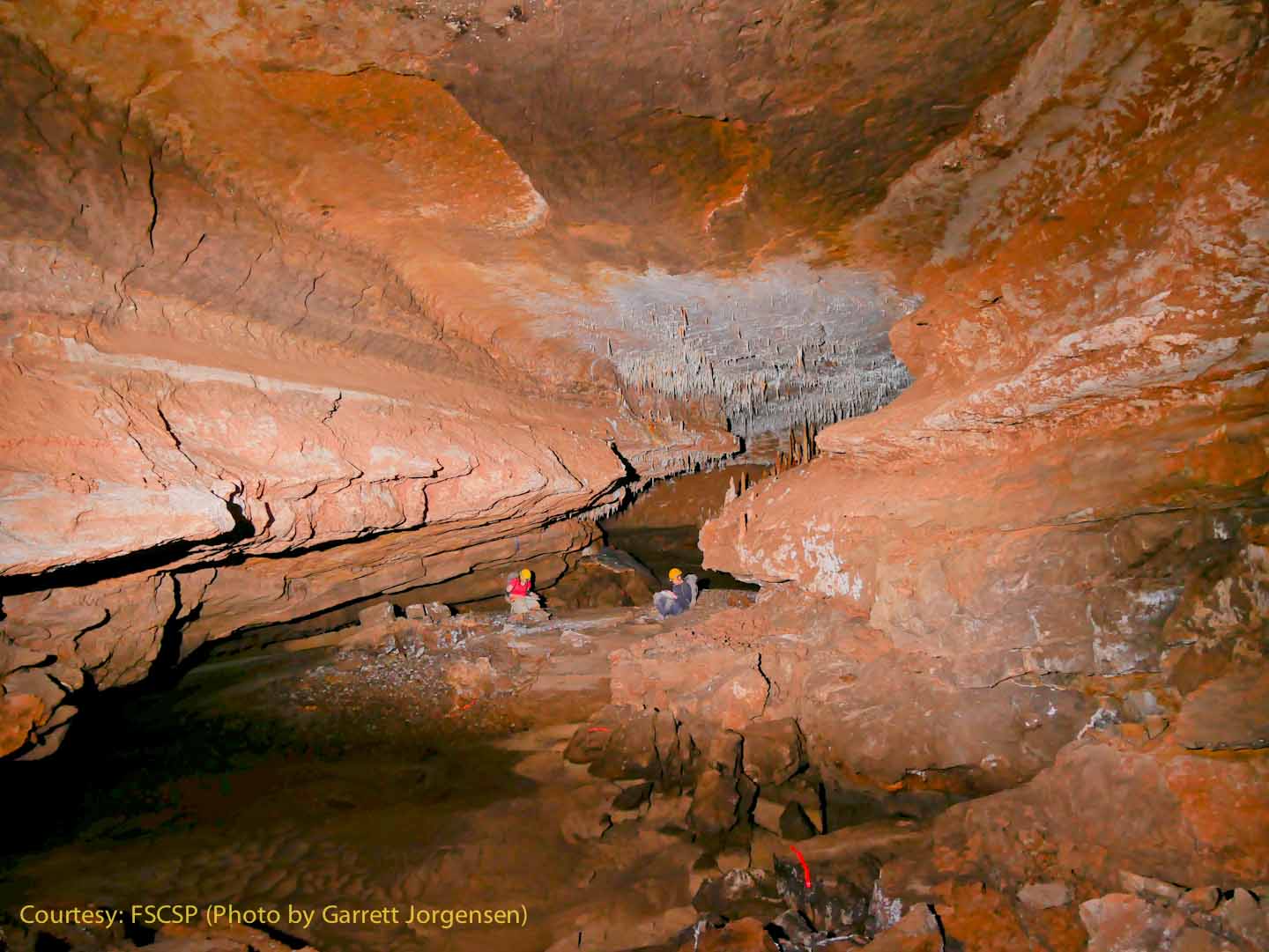
Near SRS754, this large chamber along the Snowy River passage appears to have a large elevated sediment bank and might be a location for a future Camp 2. |
|
Sometimes an abundance of stalactites indicates water leakage from the surface. Note the floor sediments and large gravel that also might indicate a surface connection.
|
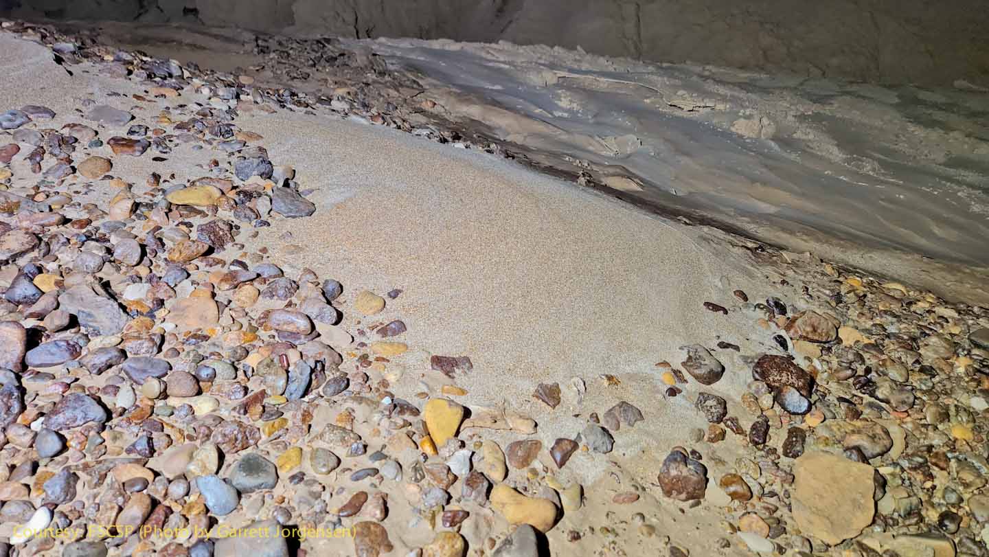
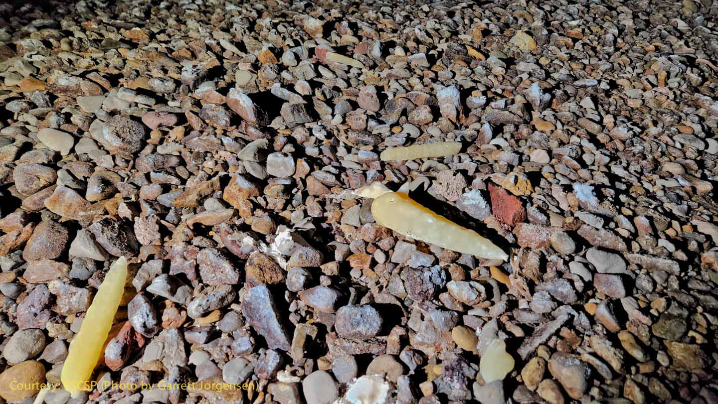
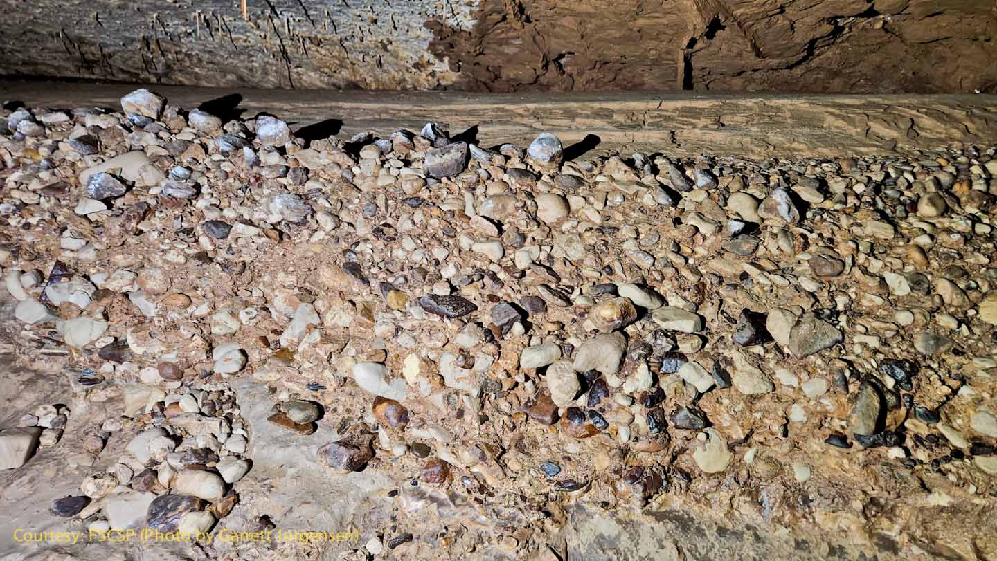
Geologists will be interested in these sediments. These rounded cobbles indicate that there was very energetic flooding in this passage at some time in the past. When the flood subsided, the sand was deposited on top of the cobbles. Note that these cobbles are not limestone and probably came from the surface above.
|
|
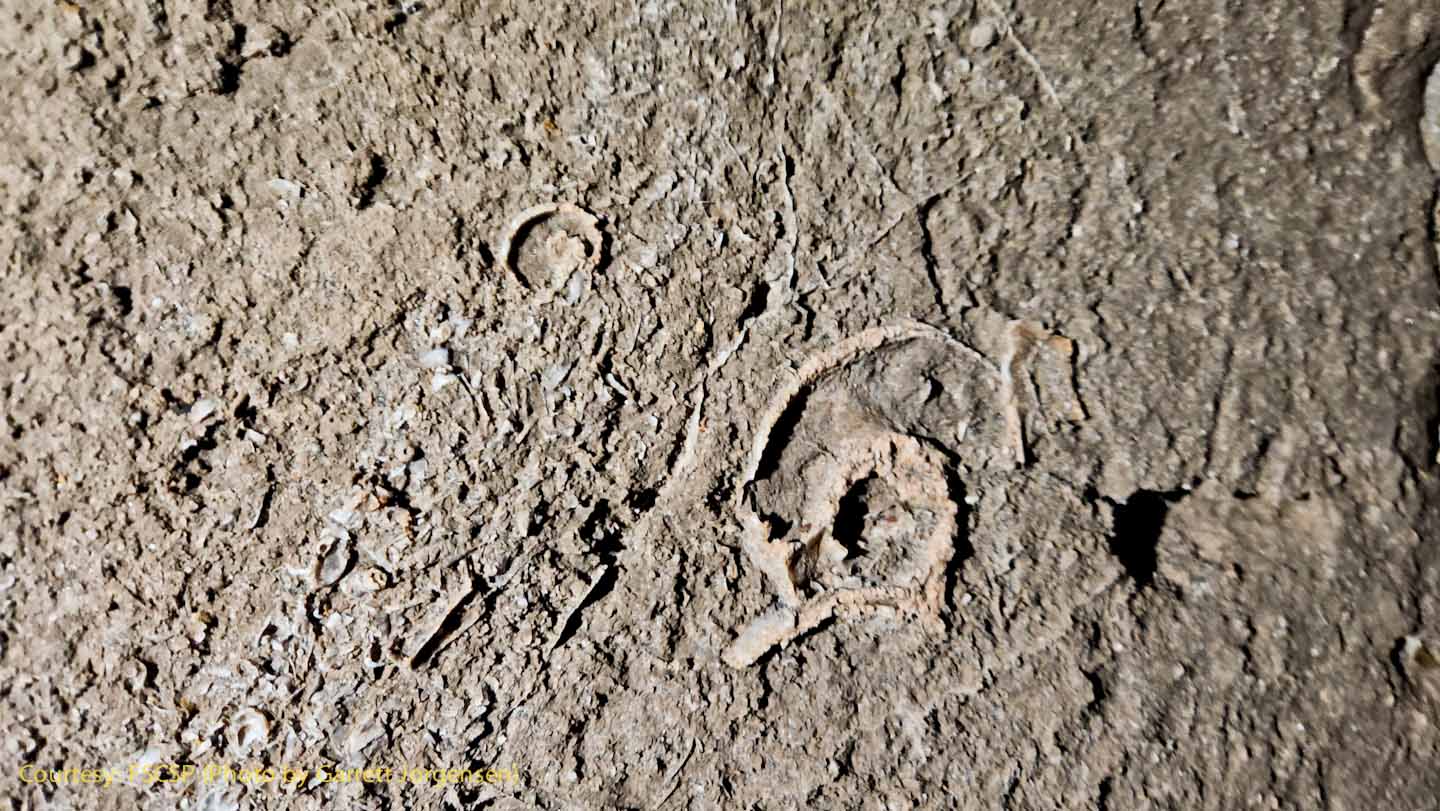
Fossils in the limestone walls of the Snowy River passage.
|
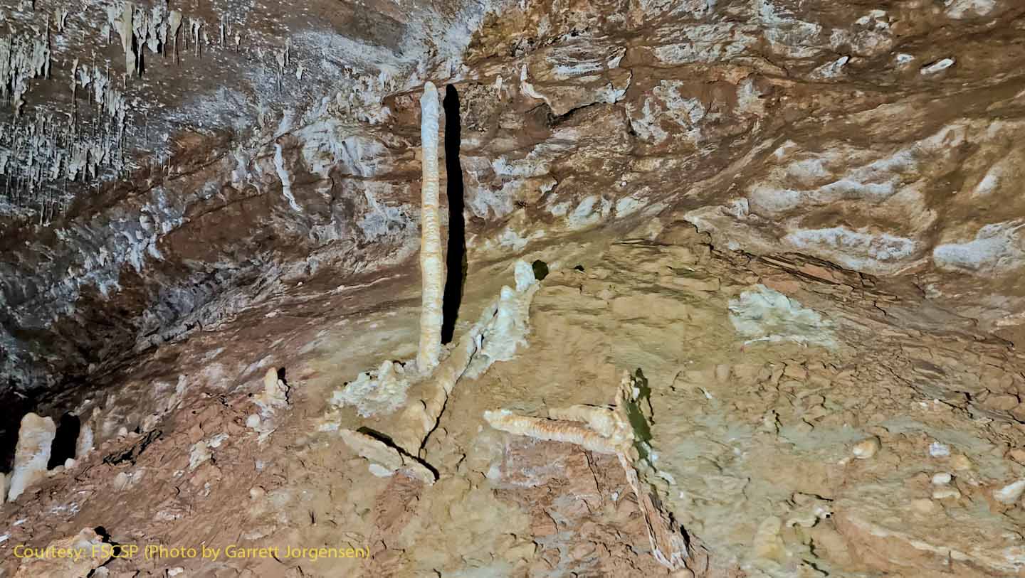
Stalagmites on a flowstone ledge that was once the floor of the passage, then the clay under the flowstone was washed away.
|
|
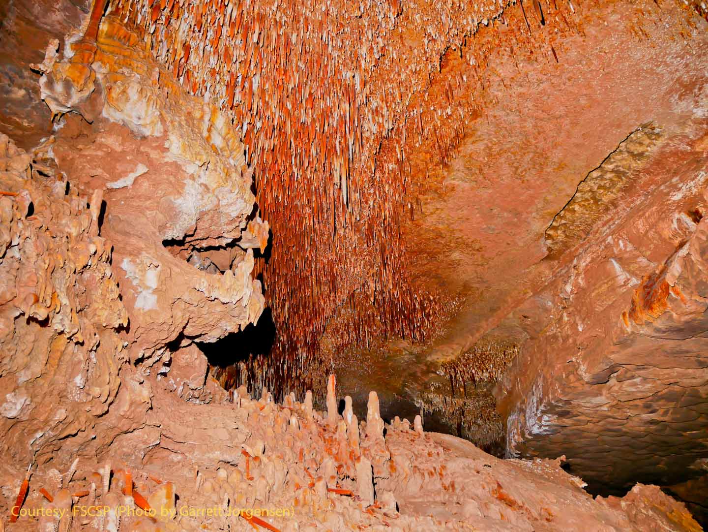
Adam in dirty mode admiring the scene in the Snowy River passage.
|
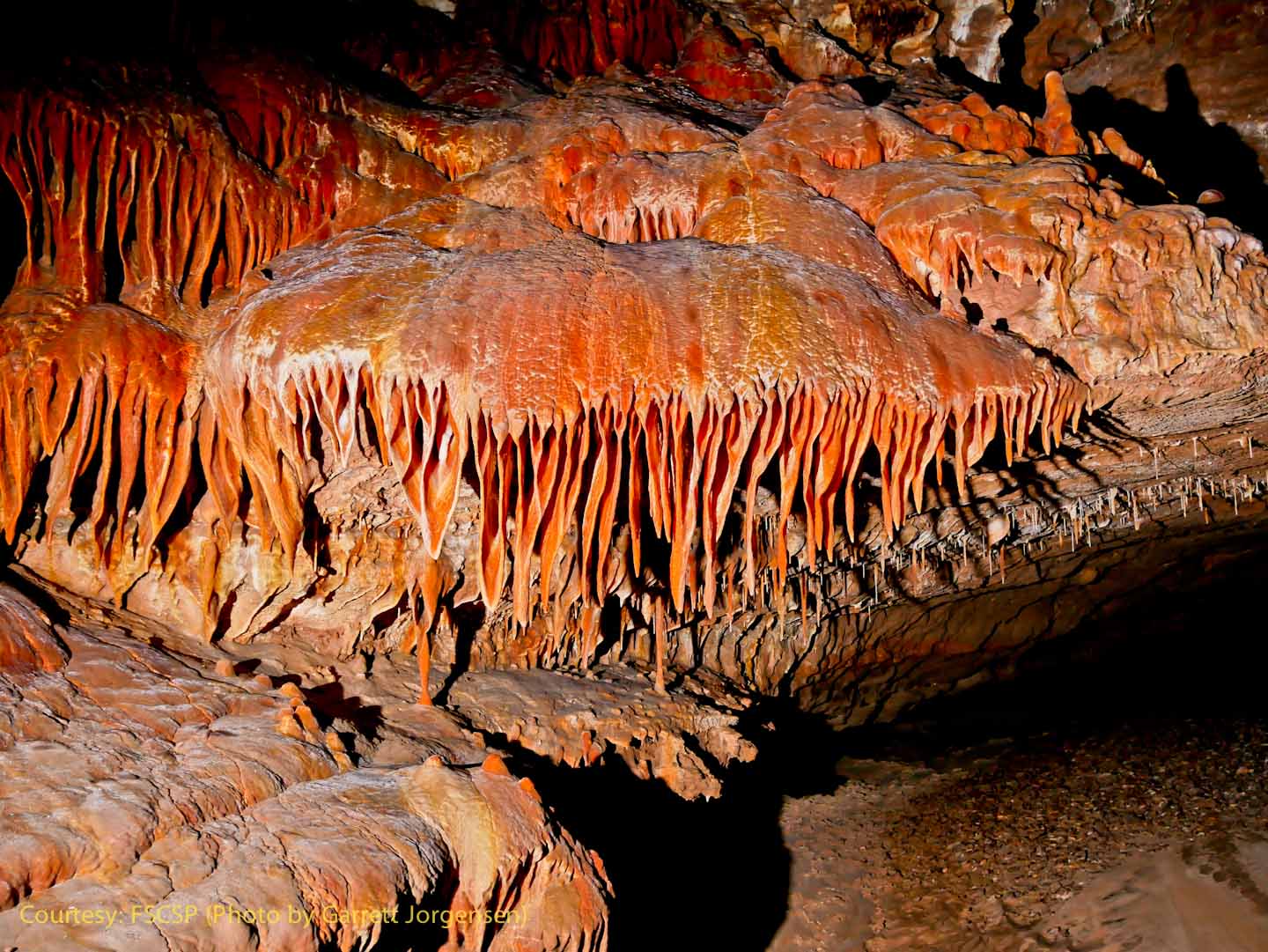
And this is what Adam was looking at – an amazing red velvet flowstone cascade. Red velvet is relatively rare, and occurs in select areas of Fort Stanton Cave.
|
|
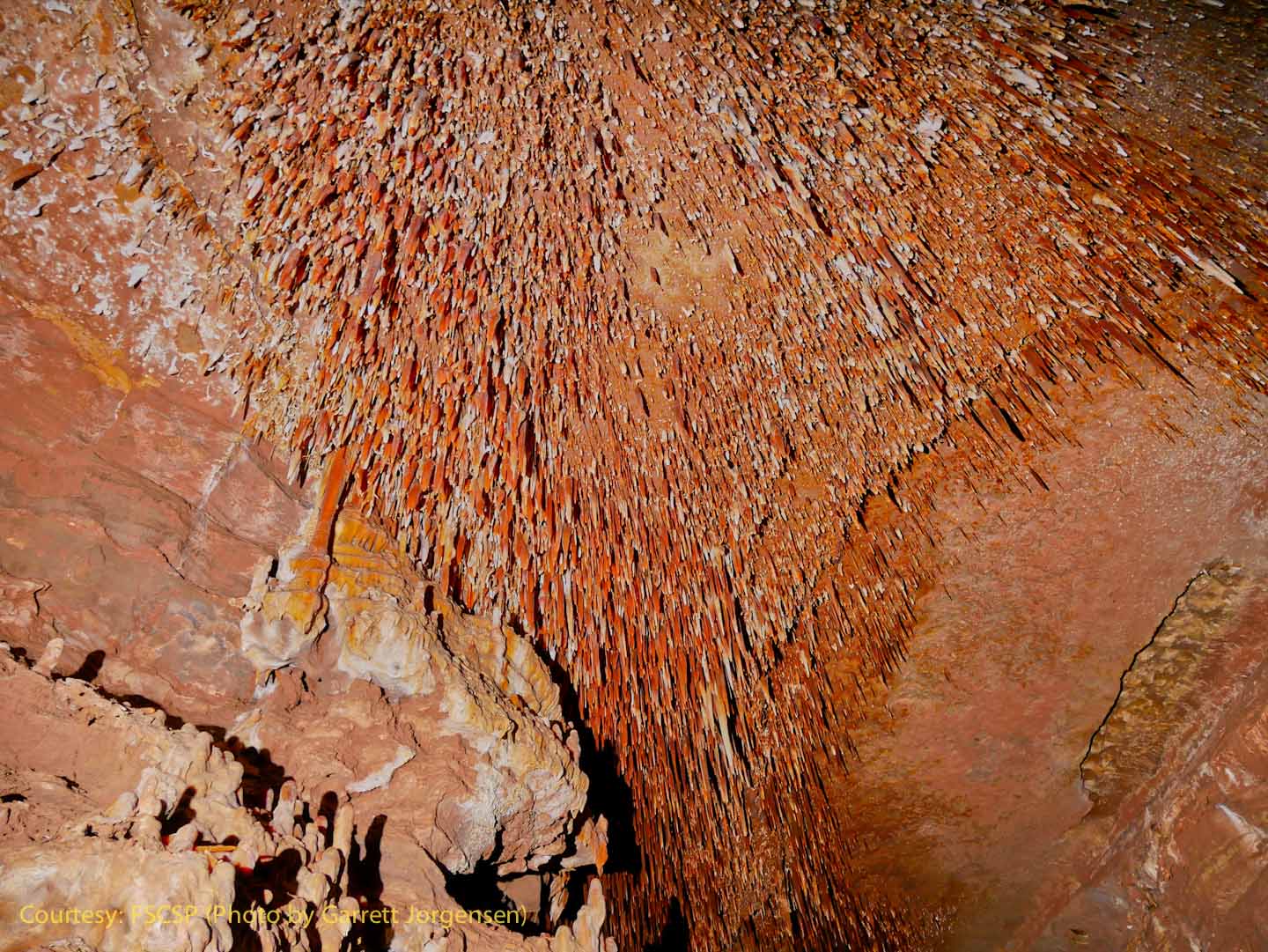
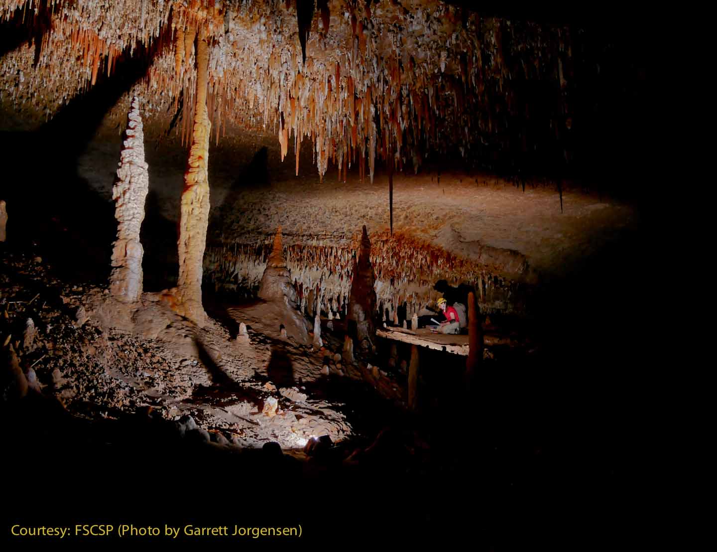
Some of the larger stalagmites and columns found in this area near SRS756. Could these be the tallest stalagmites in Fort Stanton Cave to date?
|
The profusely decorated ceiling in this area. The tiny white worm-like formations are called helictites.
|
|
Rene sets a tiny blue flagging tape for the next survey station. |
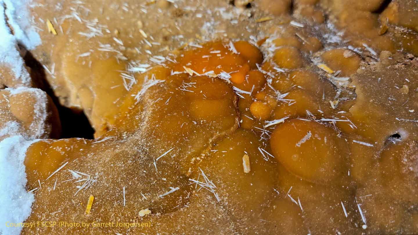
This is an interesting closeup of an orange calcite formation with an apparent gypsum needle growth on the top. The calcite is usually formed by dripping water, but gypsum needles are usually found in much drier conditions. |
|
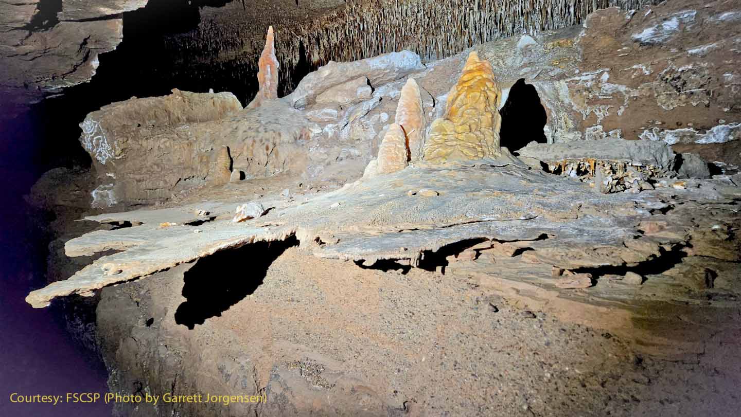
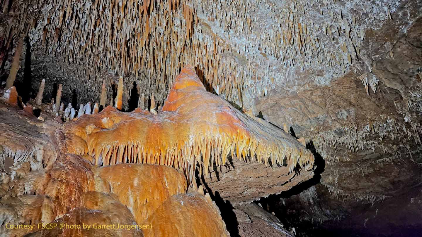
A massive stalagmite and flowstone cascade is near SRS758.
|
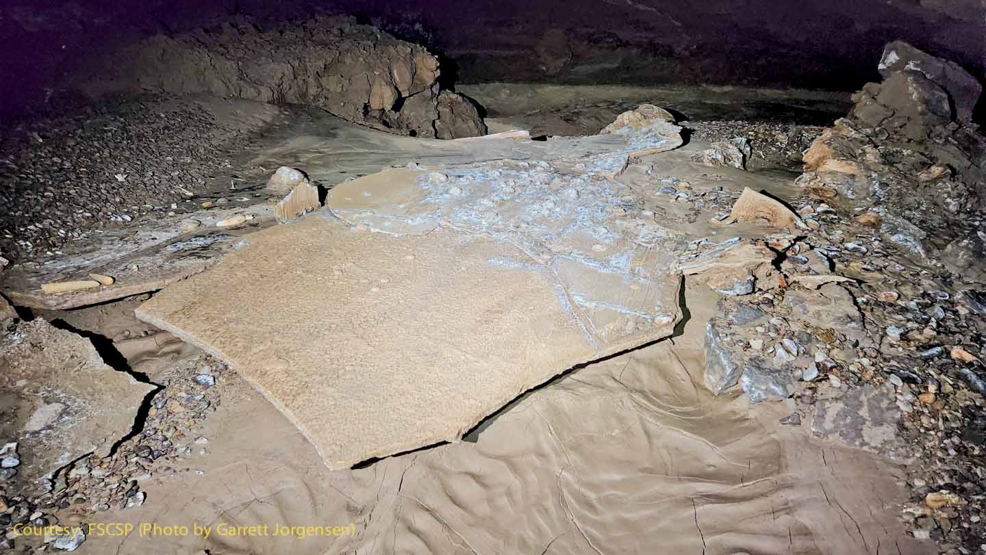
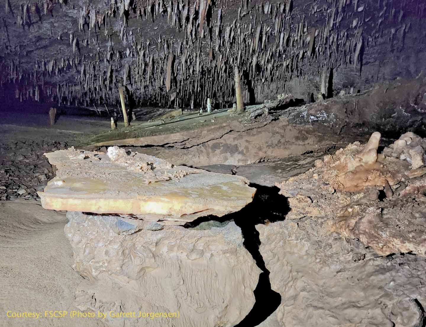
This flat plate was the floor of the passage with clay underneath. Some of the clay was washed away, but not all, as you can see the ripple marks in the clay at the bottom of the photo. The remnant floor plate broke off and may have been displaced from its original position by the water flowing through the passage.
|
|
Naturally broken stalactites could have fallen to the floor from above, or perhaps were even washed downstream by flooding waters before the Snowy River calcite started forming. |
Rene and Derek pause to enhance their sketches of this section of major trunk passage, similar in cross section to the Main Entrance Corridor 11 miles downstream. |
|
A tall (2 foot?) stalagmite remains standing on this clay slope, while others have toppled over as water washed away their clay footing. |
The origin and size of these rounded cobbles can provide geologists with additional information on the ancient water flow, most likely before the Snowy River calcite was formed. |
|
How did this table form? A remnant of what used to be the floor of the passage is now perched upon this boulder when the supporting clay was washed away. |
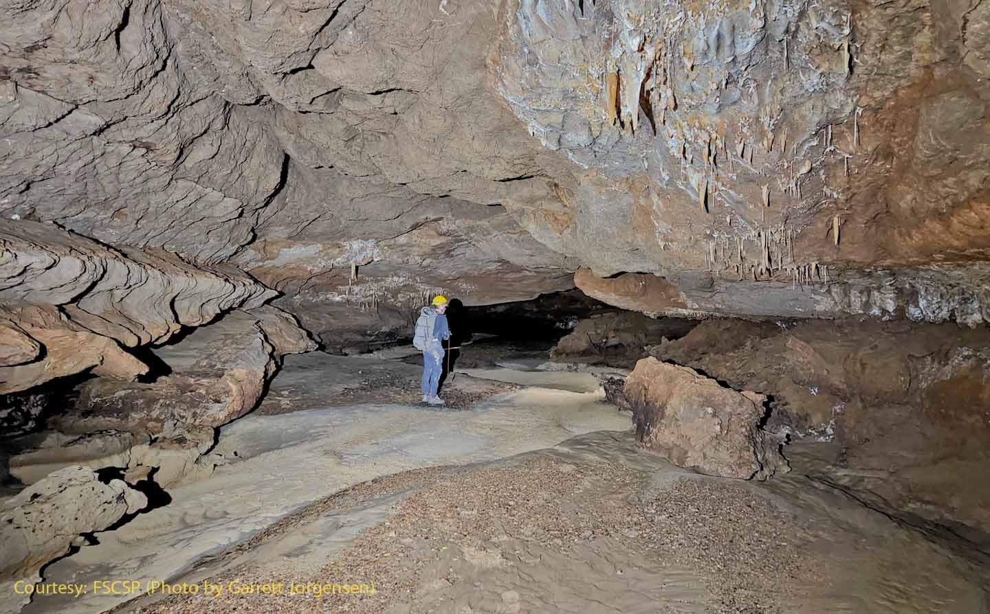
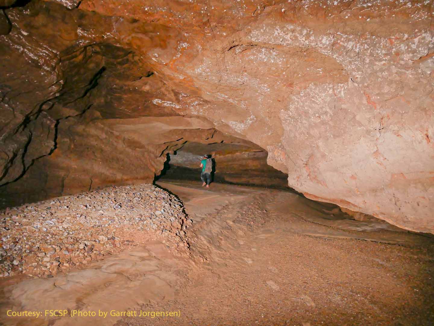
Man's first footprints leading up the clay bank next to another sediment pile. |
Rev. 9-17-2022 |
Comments to the webmaster |
Contact the FSCSP President |
Contact the Project Director |